Improve corner tracking on hard-wired devices
While in a trip, our powered devices will log according to the following set of default parameters:

This means a log will occur if:
- 1-minute passes (log at least every 60 sec)
- The asset travels over 500m
- The device experiences a 10-degree heading change over the course of 150 metres.
The heading change log means that the trips plotted by the device can follow the actual path of the road, without clipping corners.
The default parameters are somewhat 'loose' - and sufficient for most applications, providing a good balance between accuracy and data usage (not generating too many unnecessary logs).
However, if you find that the Trip History Map clips corners, making adjustments is simple.
Just make the heading change logs more sensitive, for example,

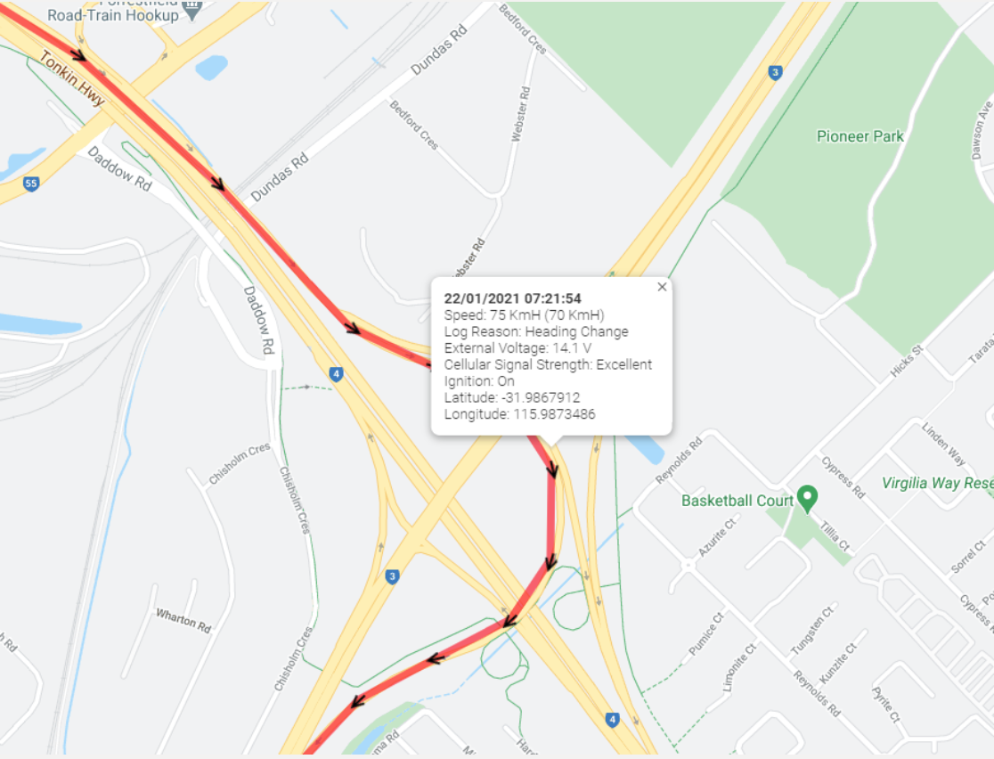
So if we experience a 60-degree direction change over a short distance (i.e. going around a corner) the device will generate a new log, so the corner is dotted on the map and we don't miss it.
This will allow for results such as the below.

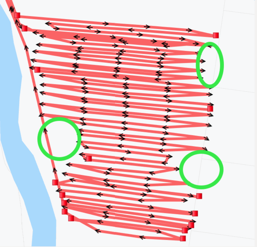
If monitoring ploughing and spraying on an asset and corners are being missed like what is seen in the example below, a few settings can be adjusted to help with registering the points.
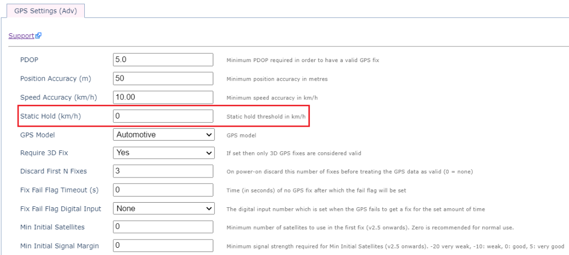
- The static hold under the GPS settings tab will need to be adjusted to “0”.
- The Heading Change Short & Heading Change Long settings must be tightened. The short can be set up as "45" and long as "50". These can be adjusted as needed.


